ilika Methane Emissions Intelligence
Transform satellite methane detections into actionable intelligence. ilika combines point-source emissions with wind modeling, facility attribution, and operational context to deliver the most comprehensive methane monitoring solution available.
Beyond Basic Detection
Most methane monitoring stops at detection. ilika goes further by integrating wind modeling, facility attribution, and operational contextto answer the critical questions: Who emitted? When? Why?
Our approach combines multi-satellite observations with atmospheric transport modeling and comprehensive infrastructure databases to deliver emissions intelligence that drives real business decisions.
Traditional vs ilika Approach
Multi-Satellite Detection Network
Primary Satellites
- • Sentinel-5P TROPOMI: Global daily coverage
- • EMIT: High-resolution point source detection
- • EnMAP: European hyperspectral missions
- • GHGSat Constellation: Commercial high-resolution data
Detection Capabilities
- • Sensitivity: Down to 100 kg/hr emission rates
- • Coverage: Global monitoring with regional focus
- • Frequency: Daily to weekly revisit times
- • Validation: Cross-satellite verification protocols
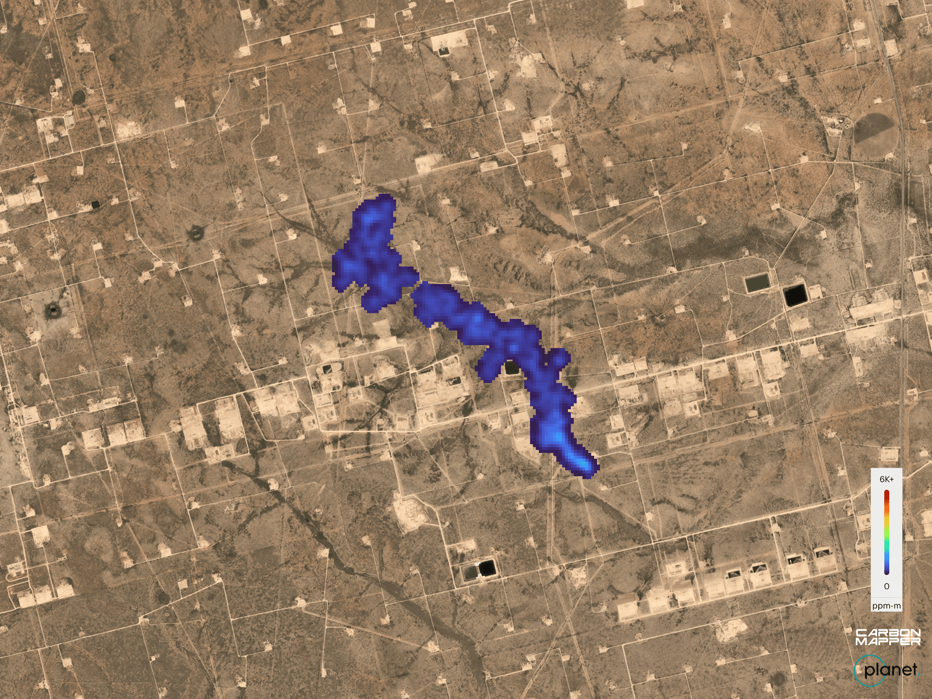
Methane Plume Detection & Attribution

Example: Satellite-detected methane plume with wind-corrected source attribution to nearby oil & gas facilities. Color intensity represents methane concentration levels.
Transforming Industries Through Emissions Intelligence
Oil & Gas Operations
Monitor equipment performance, detect fugitive emissions, and optimize maintenance schedules
Regulatory Agencies
Enhance enforcement capabilities with objective, science-based emissions evidence
Investment Firms
Integrate emissions data into ESG frameworks and investment decision-making
Why Choose ilika Methane Emissions Intelligence?
We don't just detect emissions—we deliver the context and attribution that makes emissions data actionable for your business.
AI-Enhanced Attribution
Machine learning models combine multiple data sources for precise facility attribution
• Automated processing pipeline
• Continuous model improvement
Real-Time Processing
From satellite overpass to actionable intelligence in under 24 hours
• Automated quality control
• Multi-satellite fusion
Custom Solutions
Tailored filtering, alerting, and delivery to match your operational needs
• Flexible delivery formats
• Integration support
Ready to Transform Your Emissions Monitoring?
Let's discuss your specific methane monitoring needs and design an ilika Emissions Intelligence solution that delivers the actionable insights your business requires. From regulatory compliance to operational optimization—we deliver results.